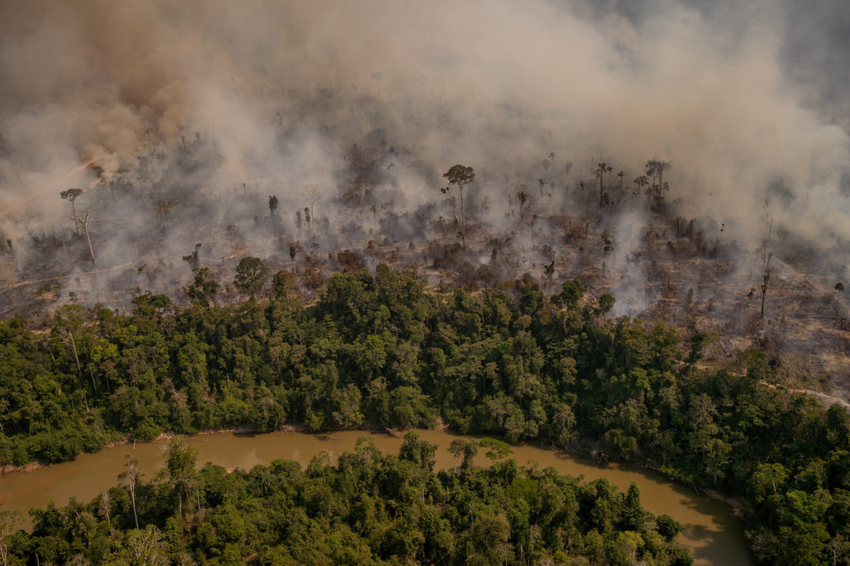
Destruction of Earth’s largest rainforest is accelerating ahead of the region’s peak fire and deforestation season, reveals data released today by Brazil’s national space research institute INPE.
According to INPE’s satellite-based deforestation tracking system, DETER, forest clearing in the Brazilian part of the Amazon amounted to 1,391 square kilometers, an area 24 times the size of Manhattan, in May. That represents a 67% increase over May 2020 and puts deforestation nearly on pace with last year’s rate, when forest loss in the region reached 11,088 square kilometers (4,281 square miles), the highest level since 2008.

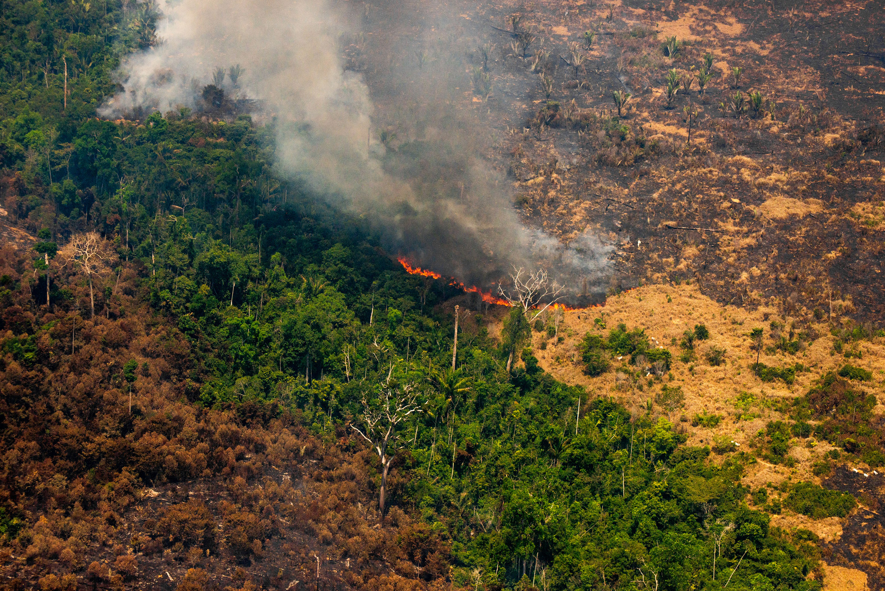
The figure also represents the highest recorded in any May since at least 2007. Deforestation in the Brazilian Amazon typically peaks from June to September, when the region experiences its dry season, which also coincides with when most fire-setting occurs.
97% of the deforestation detected during the month occurred in just four states: Pará (37%), Amazonas (25%), Mato Grosso (20%), and Roraima (15%). Pará and Mato Grosso normally rank as the top deforesters in Brazil due to cattle ranching and clearing for agriculture. Amazonas and Roraima typically do not top the list of states in terms of deforestation. Acre, a state that has historically had high rates of deforestation but has implemented measures to control forest clearing, accounted for only 2%.
Deforestation associated with mining amounted to 38 square kilometers, 88% of which occurred in Pará. While mining represents only a small fraction of forest clearing, the figure in May is the highest since INPE started monthly tracking under its current system in August 2016. Mining in the region has been attracting attention of late due land invasions and associated violence against Indigenous communities by wildcat miners.


Scientists are bracing for a bad fire season in the southern and eastern Amazon, an area known as the “arc of deforestation” for its high rates of clearance, due to below average rainfall during the most recent rainy season. Fires the past two years have made international headlines, calling public attention to the surge in deforestation under Brazilian President Jair Bolsonaro. Fires are already burning in the Amazon, according to the Amazon Conservation Association’s Monitoring of the Andean Amazon Project (MAAP), which tracks burning in the region.
A resurgence of fire and deforestation in the Amazon is heightening concerns about the fate of Earth’s largest rainforest, which stores billions of tons of carbon, houses millions of people including scores of Indigenous tribes, and serves as the planet’s greatest refuge for biodiversity. Roughly 20 percent of the Amazon has been cleared since the 1970s and researchers fear that the ecosystem could be approaching a point where vast areas transition toward drier habitat akin to that of the adjacent Cerrado and Chaco biomes. There are already signs this may be underway, including changes in species assemblages, reduced humidity, and tree die-offs in the southern reaches of the Amazon.

These worries have spurred international condemnation of the forest policies of the Bolsonaro administration. Since taking office in January 2019, Bolsonaro has rolled back protections for the Amazon, cut budgets for environmental law enforcement, granted amnesty for some illegal deforesters, and used heated rhetoric against environmentalists and Indigenous peoples.
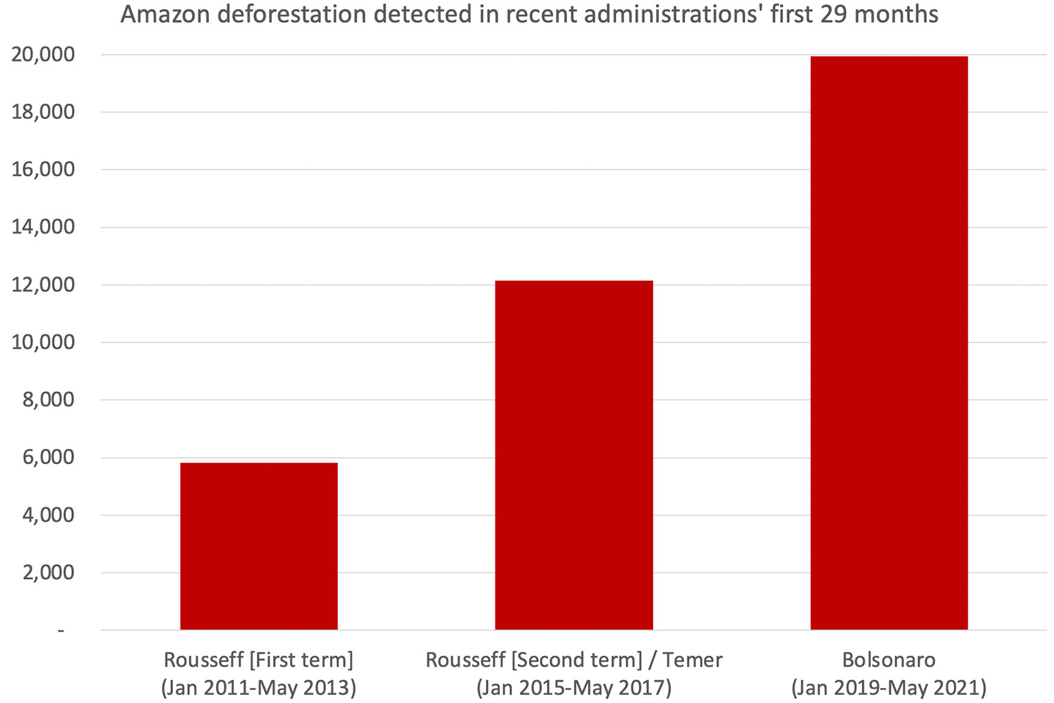
Deforestation under the Bolsonaro administration through its first 29 months is more than three times higher than under Dilma Rousseff, the last president for which there is equivalent period of rule, while violence has jumped — data published last month by the Pastoral Land Commission showed a record number of land conflict cases in 2020.
NOTE: This is an updated version of last week’s May deforestation in the Amazon hits 14-year high